 |
PACIFIC CREST TRAIL, MT. GLEASON TO NORTH FORK SADDLE NOVEMBER 2013 |  |
| Photographs by Michael Charters |
 |
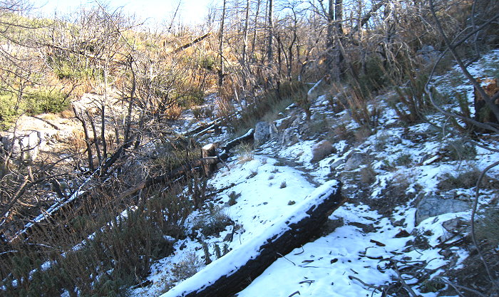
From Mt. Gleason to North Fork Saddle it is approximately 6-1/2 miles. As the above picture shows there was some snow along the trail from a recent storm. The trail drops from about 6500' to 4200'. I did this section in a couple of segments. There is really not enough in the way of interesting or different plants to justify putting together a photo gallery, and my purpose as I hiked this in late November was basically to familiarize myself with the trail and figure out where to park to facilitate breaking up this section into manageable pieces. I did record about 45 species for my PCT list. I will not do another photo gallery this year, but beyond this section there is still the 8.7 mile basically downhill drop to Soledad Canyon Road at 2200' which I will finish sometime in the next couple of weeks. At that point I will have hiked 101 miles from the I-15 at Cajon and completed the San Gabriel Mountains portion of the Pacific Crest Trail. Next year I intend to begin with the eastern sections in the spring and perhaps do Mill Creek Summit to Soledad Canyon Road over the summer. |
| PHOTO GALLERIES INDEX |
CALFLORA.NET | |
| CALIFORNIA PLANT NAMES: LATIN AND GREEK MEANINGS AND DERIVATIONS | ||
| VIRGINIA PLANT NAMES: LATIN AND GREEK MEANINGS AND DERIVATIONS | ||
Copyright © 2013 by Michael L. Charters.
The photographs contained on these web pages may not be reproduced without the express consent of the author.
Comments and/or questions may be addressed to: mmlcharters[at]gmail.com.